
| UPSC Relevance GS1 (Geography): Climate change impacts on oceans & coastal geomorphology. GS3 (Environment): Coral reef ecosystems, sea-level rise, adaptation strategies. Essay: “Rising seas and sinking islands: Challenges of the 21st century.” |
Why in News?
A recent study led by Paul Kench (National University of Singapore) and researchers from Nanyang Technological University has revealed that sea levels around Maldives, Lakshadweep, and Chagos archipelago have been rising faster and earlier than previously thought. Using coral microatolls as natural record-keepers, the study reconstructed sea-level changes from 1930–2019, challenging the assumption that significant rise began only in the 1990s.
Background: Understanding Sea-Level Rise
Why are sea levels rising?
Global warming is heating up the planet. When oceans absorb this heat:
- Thermal expansion → Warm water expands, just like milk boiling and rising in a pot.
- Melting ice → Glaciers and polar ice sheets melt, adding extra water to the oceans.
👉 Both these processes push sea levels upward across the world.
Who faces the greatest risk?
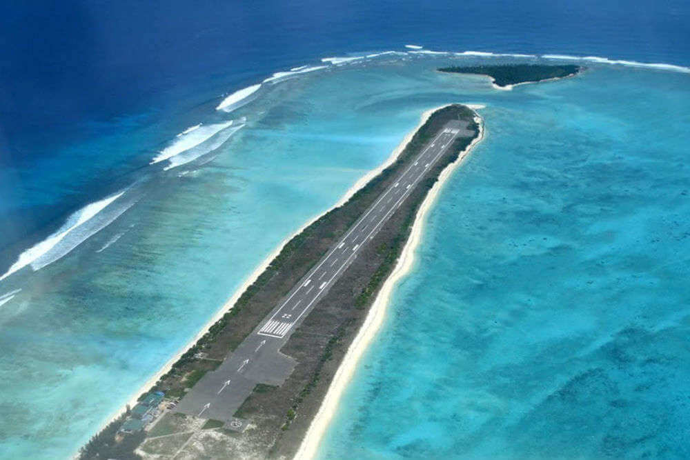
- Think of countries like Maldives, Tuvalu, Kiribati.
- In India, think of Lakshadweep and Andaman & Nicobar Islands.
- Why them? Because most of their land is just 1–2 metres above sea level.
How do scientists measure sea levels?
Traditionally, they used two main tools:
- Tide gauges → Like rulers placed at coastal areas, recording water levels. But they’ve been used only since the 1950s.
- Satellites → Since the 1990s, satellites have been measuring sea-level changes from space.
The problem: Both are recent methods. They cannot tell us how sea levels were changing 100+ years ago.
The New Method – Coral Microatolls
- Scientists recently tried a new approach. They studied coral microatolls.
Key Concept: Coral Microatolls
1. Definition
- Coral microatolls are disk-shaped colonies of coral.
- Their upward growth is limited by the lowest tide level of the sea in that region.
- Once they reach that limit, they cannot grow higher (otherwise they would be exposed to air and die).
👉 Imagine filling a glass with water. Once the water reaches the rim, it can’t rise further, so it spreads sideways. Similarly, these corals grow outward, not upward, once they hit the tide limit.
2. Function as Natural Tide Gauges
- Since they stop vertical growth at the lowest tide level, their flat upper surface acts as a “marker” of past sea-level height.
- Over time, as sea levels rise or fall, the coral surface records these changes.
👉 In simple words: Coral microatolls = nature’s tide gauges, recording sea-level history long before satellites or tide meters were invented.
3. Longevity
- Microatolls can live for decades to centuries.
- They grow sideways (laterally), producing growth bands each year (just like tree rings in a trunk).
- These annual growth rings preserve a timeline of environmental and sea-level changes.
👉 That’s why scientists often call them the “tree rings of the ocean”.
4. Scientific Use
Scientists study coral microatolls using modern techniques:
- X-ray banding → Shows annual growth bands clearly.
- Uranium-thorium dating → Provides precise ages of coral layers (sometimes accurate to ±2 years).
By combining these, scientists can reconstruct sea-level changes going back 100–200 years, far beyond the reach of tide gauges and satellites.
Coral microatolls extend our understanding of sea-level rise by adding ~90 years of historical records in the Indian Ocean. This is crucial for small island nations and India’s island territories facing existential risk from climate change.
Data and Findings from the Study
1. Rate of Sea-Level Rise (1930–2019)
Scientists studied a Porites microatoll in Mahutigalaa, Maldives. They reconstructed 90 years of sea-level history.
- 1930–1959 → Rise was slow, only 1.0 – 1.84 mm/year.
- 1960–1992 → Rise became faster, about 2.76 – 4.12 mm/year.
- 1990–2019 → Even faster, nearly 3.91 – 4.87 mm/year.
👉 Over the full 90 years, sea level went up by ~30 cm (0.3 metres).
2. Acceleration Timeline
- Earlier, scientists thought sea-level rise accelerated only in the 1990s.
- But this coral record shows that acceleration actually began in the late 1950s.
👉 This means human-driven climate impacts (linked to rising emissions post-World War II industrialisation) were visible earlier than we assumed.
3. Regional Context
In the Maldives, Lakshadweep, and Chagos archipelago:
- Since 1959 → rise of ~3.2 mm/year.
- In the last 20–30 years → rise sped up to ~4 mm/year.
⚠️This is dangerous because these islands are only 1–2 metres above sea level. A few more decades of such rise could submerge large parts of them.
4. Climatic Signals Preserved in Corals
Coral microatolls not only record sea level, but also preserve climate stress events:
- El Niño events → Warmer water, bleaching → seen as growth interruptions.
- Negative Indian Ocean Dipole (IOD) → Alters currents, stresses corals → also recorded.
- 18.6-year lunar nodal cycle → This natural cycle changes tides slightly, and corals recorded its influence too.
👉 This shows corals are like climate archives, storing multiple signals about ocean and atmosphere.
Why These Findings Matter
1. Challenges Old Assumptions
- Until now, scientists and policymakers believed that serious sea-level rise began only in the 1990s, when global warming picked up speed.
- But this new study (using coral microatolls) shows that sea-level rise started accelerating in the late 1950s.
- This means that climate impacts began earlier than we assumed, making our previous models and risk assessments too optimistic.
2. Reveals Regional Variation
- Global average sea-level rise = ~3.0 mm/year.
- But in the central Indian Ocean (Maldives, Lakshadweep, Chagos) = ~3.3 mm/year.
- Even a small difference matters because these islands sit barely above sea level.
- This shows that regional sea-level rise can be higher than the global average, so local adaptation plans must be tailored to specific regions.
3. Implications for Adaptation
- If seas started rising faster in the 1950s, then island nations have been under threat for 70+ years, not just the last 30 years.
- This means that adaptation planning (like coastal defenses, relocation, or climate-resilient infrastructure) is already lagging by decades.
- For countries like Maldives or territories like Lakshadweep, this is not just an environmental issue, but an existential survival issue.
Implications for Maldives, Lakshadweep, and Coastal India
1. Coastal Erosion
- With faster sea-level rise, shorelines are pushed back.
- Lakshadweep islands are especially vulnerable because they are made of sand and coral — both easily eroded.
- Already, studies show that many islands in Lakshadweep are shrinking in landmass, reducing habitable and cultivable land.
- This not only affects housing and agriculture but also increases risk during cyclones and storm surges.
2. Habitability Threat
- The Maldives’ average elevation is only ~1.5 metres above sea level, making it one of the most threatened nations in the world.
- Even India’s islands like Minicoy and Kavaratti in Lakshadweep face similar dangers, as they are just 1–2 metres above sea level.
- This raises an existential question: will some of these islands remain habitable 50–100 years from now?
3. Coral Bleaching & Reef Collapse
- Rising seas reduce the amount of sunlight that reaches coral reefs.
- Corals depend on sunlight for photosynthesis (through their symbiotic algae).
- Less light + warmer waters = coral bleaching.
- If bleaching continues, reef ecosystems collapse, destroying natural barriers that protect islands from waves and erosion.
- This creates a vicious cycle: sea-level rise damages reefs → weaker reefs mean more erosion → faster land loss.
4. Socio-Economic Risks
- Fisheries Loss
- Maldives and Lakshadweep depend heavily on tuna and reef fish.
- Reef collapse and changing sea conditions will reduce fish stocks, threatening local food security and livelihoods.
- Tourism Decline
- Both Maldives and Lakshadweep rely on tourism (beaches, coral diving, resorts).
- If islands shrink and corals die, tourism — the backbone of their economy — will collapse.
- Climate-Induced Migration
- As land becomes uninhabitable, people will be forced to migrate.
- Maldives has even discussed buying land abroad (like in Sri Lanka or Australia) to relocate citizens in the worst-case scenario.
- For India, migration from Lakshadweep to mainland coastal areas could create new socio-economic stresses.
Sea-level rise is not just an environmental problem, but also a development, economic, and human security issue for Maldives, Lakshadweep, and coastal India.
Historical Context of Monitoring
1. TOGA Program (1985–1994)
- The Tropical Ocean Global Atmosphere (TOGA) program was one of the first major international efforts to study the Indian Ocean’s role in climate.
- It set up long-term monitoring systems — mainly tide gauges and ocean buoys — to track sea-level changes, currents, and temperature.
👉 This was a big step in building systematic ocean records for the region.
2. Global Sea Level Observing System (GLOSS)
- After TOGA, the Global Sea Level Observing System (GLOSS) carried forward the mission.
- It maintained a network of tide gauges worldwide, including the Indian Ocean.
- Data from GLOSS helped scientists build global sea-level rise estimates.
3. Indian Ministry of Earth Sciences Findings
- India’s Ministry of Earth Sciences (MoES) reports that the Indian Ocean sea level is rising at ~3.3 mm/year, which is slightly higher than the global average of ~3.0 mm/year.
- This shows that regional factors (currents, winds, warming hotspots) make the Indian Ocean especially vulnerable.
4. The Gap in Monitoring
- Despite TOGA and GLOSS, the central tropical Indian Ocean (around Maldives, Lakshadweep, Chagos) was still poorly monitored.
- Most data came only from the 1950s onward, missing out on earlier sea-level history.
👉 This is where the new coral microatoll study is crucial — it fills a 90-year gap in records, giving us long-term insights that instruments could not provide.
Global and National Steps Taken
1. Paris Agreement (2015)
- The landmark global climate treaty under the UNFCCC.
- Countries agreed to keep global warming well below 2°C, ideally at 1.5°C, compared to pre-industrial levels.
- Why important for sea-level rise?
- Less warming → slower melting of glaciers and ice sheets.
- Less thermal expansion of oceans.
In other words, the Paris Agreement is an indirect safeguard against sea-level rise.
2. India’s Coastal Mission (NAPCC)
India launched the National Action Plan on Climate Change (NAPCC) in 2008.
One of its sub-missions is the National Coastal Mission, which aims to:
- Protect coastal ecosystems (mangroves, coral reefs, beaches).
- Strengthen coastal defenses (sea walls, bio-shields).
- Safeguard the livelihoods of fisherfolk and coastal communities.
For India, with 7,500 km of coastline + vulnerable island territories, this mission is critical.
3. Maldives’ Climate Diplomacy
- The Maldives is one of the world’s lowest-lying nations (avg. elevation: 1.5 m).
- It has become a global voice for island nations through the Alliance of Small Island States (AOSIS).
- Maldives consistently raises the alarm in UN climate talks, highlighting the existential risk of sea-level rise.
Its diplomacy is not just symbolic — it pushes major emitters to take stronger climate action.
4. Research Gaps
Despite progress, there are still serious gaps in long-term monitoring.
For example:
- Tide gauges and satellites give us data for only 70 years or less.
- Poor coverage in the central Indian Ocean (Maldives, Lakshadweep) has limited projections.
- The coral microatoll study is valuable because it fills this 90-year data gap, giving us better tools to plan adaptation.
Way Forward
1. Strengthen Monitoring Systems
- Expand tide gauges and satellite coverage in the Indian Ocean to track sea-level changes more precisely.
- Integrate coral microatoll studies in Maldives, Lakshadweep, Andamans, and Seychelles to create a long-term regional record.
This will give policymakers early warnings and help in scientific projections for 50–100 years ahead.
2. Adaptation Measures
Climate-resilient infrastructure:
- In Maldives and Lakshadweep, coastal defenses (sea walls, raised housing, floating infrastructure) are urgently needed.
- For example, Male city (Maldives) has already built a sea wall with Japanese support. Similar steps are needed elsewhere.
Ecosystem-based adaptation:
- Mangrove restoration acts as a natural barrier against waves and erosion.
- Coral reef conservation ensures reefs continue protecting islands and supporting fisheries.
Combining “grey infrastructure” (walls) with “green infrastructure” (mangroves, reefs) makes adaptation more sustainable.
3. Policy Support
- India must prioritise coastal vulnerability mapping under the National Coastal Zone Management Programme (NCZMP).
- This means identifying which villages, towns, and islands are most at risk and creating relocation and livelihood plans in advance.
This proactive approach will reduce human and economic losses in future.
4. Regional Cooperation
- India should work closely with Maldives, Sri Lanka, and Seychelles under the Indian Ocean Rim Association (IORA).
- Joint efforts can include:
- Shared early-warning systems for sea-level rise and storms.
- Regional research hubs on ocean warming and coral conservation.
Climate change is a regional threat, so the response must also be regional and cooperative.
5. Climate Diplomacy
- India can use this new scientific evidence (coral study) in global climate negotiations.
- By highlighting the special vulnerability of the Indian Ocean region, India and Maldives together can push for:
- Stronger global emission cuts.
- More climate finance for adaptation projects.
This strengthens India’s moral and diplomatic position in forums like UNFCCC, COP summits, and G20.
Conclusion
The coral microatoll study (1930–2019) fundamentally reshapes our understanding of sea-level rise in the Indian Ocean, proving that Maldives, Lakshadweep, and Chagos have been facing threats much earlier than assumed. With sea levels rising 30–40 cm in the past 60 years, the region’s ecological and socio-economic security is under severe threat. For UPSC aspirants, the case highlights the importance of scientific evidence in climate policy, the intersection of environment and geopolitics, and the urgent need for adaptive governance in vulnerable coastal areas.
NOTE- for more detail also read-8th august article on Great Barrier Reef: Record Coral Loss and Its Global Implications
UPSC Prelims Practice Questions
Q1.The coral microatoll study in the Maldives revealed that sea-level rise has been influenced by:
- El Niño events
- Negative Indian Ocean Dipole (IOD) events
- The 18.6-year lunar nodal cycle
- Tectonic instability of the region
Which of the above factors were identified?
- (A) 1, 2 and 3 only
- (B) 2, 3 and 4 only
- (C) 1 and 4 only
- (D) 1, 2, 3 and 4
Answer: (A) 1, 2 and 3 only
(The region was tectonically stable, hence tectonic instability was not a factor.)
Q2. Consider the following statements regarding coral microatolls:
- They are disk-shaped coral colonies whose upward growth is restricted by the height of the lowest tide.
- Their upper surface closely reflects the lowest water levels in the area over time.
- They can provide long-term sea-level records spanning decades or centuries.
Which of the statements given above is/are correct?
- (A) 1 and 2 only
- (B) 2 and 3 only
- (C) 1 and 3 only
- (D) 1, 2 and 3
Answer: (D) 1, 2 and 3
UPSC Mains Practice Question
Q. “The study of coral microatolls in the Maldives has revealed an earlier onset of sea-level rise in the Indian Ocean than previously estimated.” Discuss the significance of this finding for India and the wider Indian Ocean region. (Answer in 250 words)
SOURCE- THE HINDU
Found this helpful?
Bookmark for revision, Practice the mains question, and
Share with fellow aspirants! THANK YOU